
For this online edition of Walk It Talk It, we take a walk inspired by the local maps created by students from First Year BA (Hons) Interior and Spatial Design at Camberwell College of Arts.
Click here to discover the all of the 61 maps, which have been collated into a digital publication. The maps have been grouped into eight sections: Food, Urban Communication, Local Stories, Sense of the City, Sustainability, Architecture, Health and Nature.
This edition of Walk it Talk it is presented by artist Laura Wilson who lives and works in the area, and features selected locations from the students maps, alongside two sites chosen and illustrated by Laura that relate to her own personal knowledge of the history of the area.
Please join us for an in person walk on Sunday 20th June at 2pm led by Laura Wilson. More information about the event and how to book is available here.
DISCOVER THE ROUTE
Discover illustrations of the chosen points of interest below and the accompanying histories.
Click here to find the route on Google Maps*, which includes the embedded illustrations and our insights.
PLEASE NOTE
* If using on your mobile, please copy the link into your mobile browser rather than opening directly into the app.
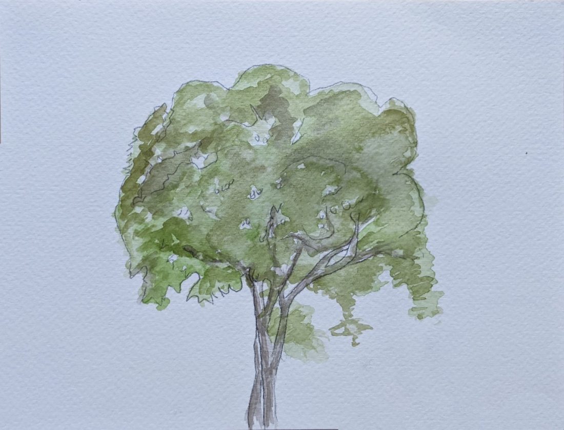
1. Ailanthus altissima / Tree of Heaven, South London Gallery, 65-67 Peckham Road
Many of the students made maps in response to the nature in the local area including mapping the green space, the number of London Plane Trees and even the location of moss growing on bricks. For this walk, I invite you to meet me at the Tree of Heaven, located outside the South London Gallery for 100 years, which died earlier this year.
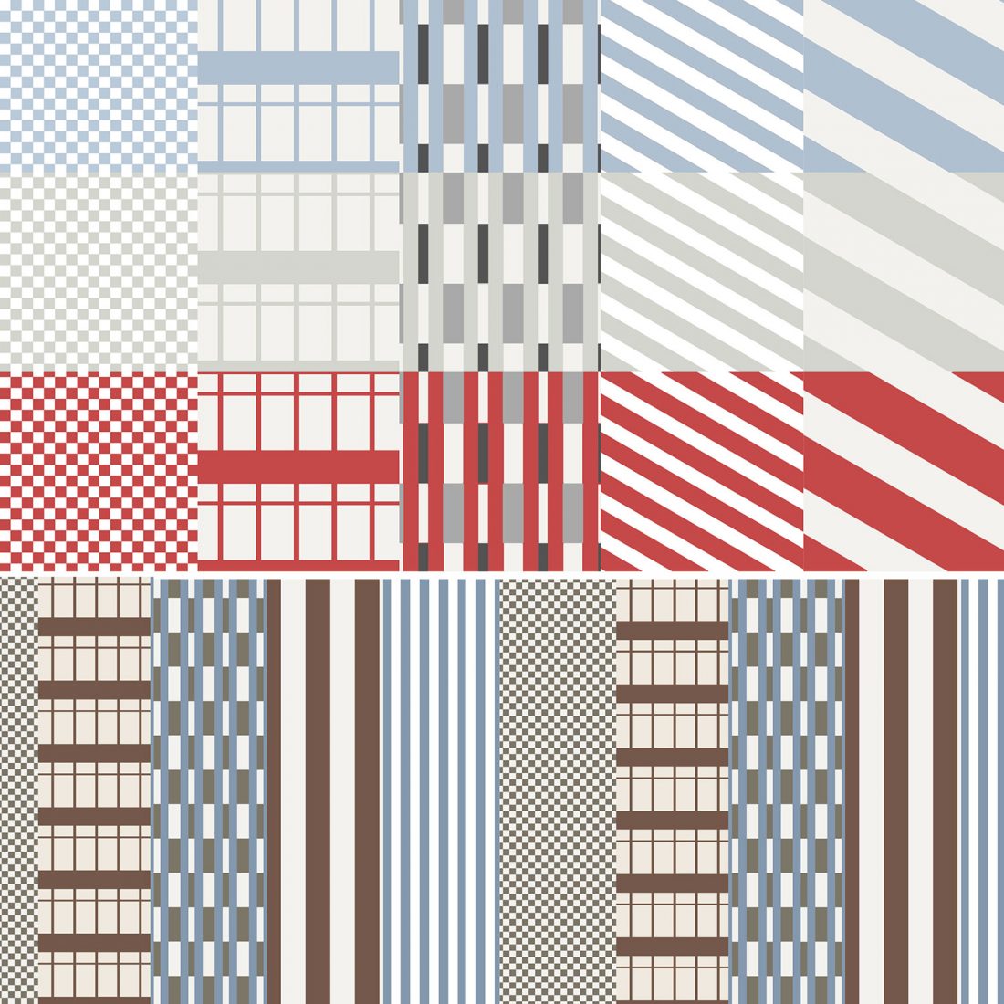
2. Colour and Pattern of Peckham Road
Harim Um created a map by extracting and collaging colours and patterns from key landmark buildings along Peckham Road. As you walk along, see if you can spot where these have been taken from.
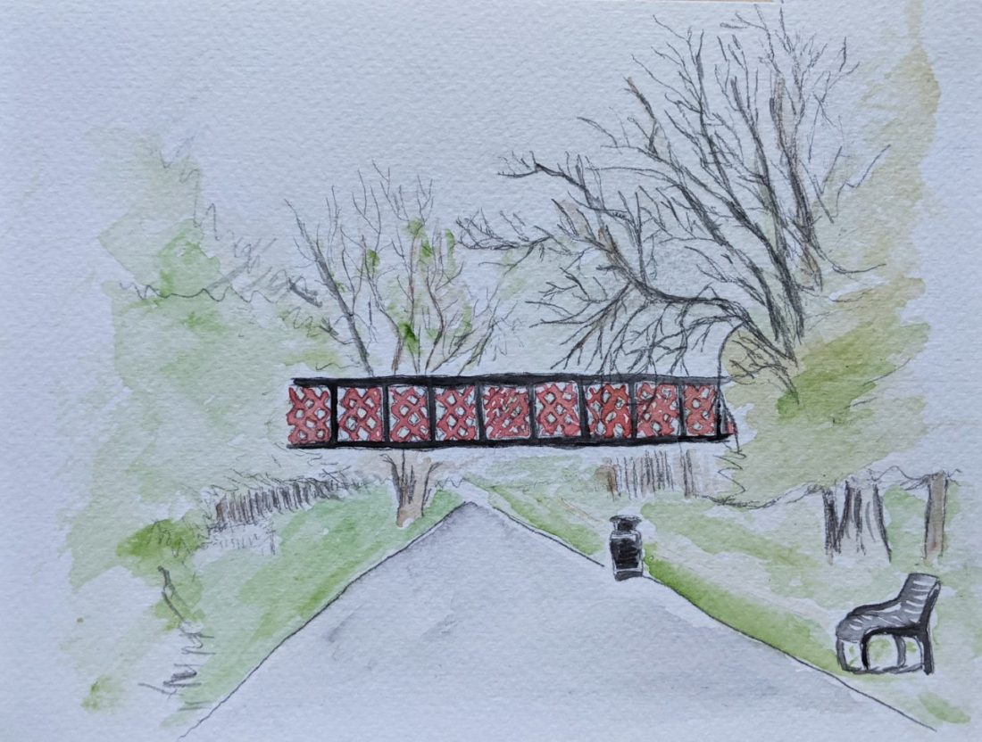
3. The Bridge to Nowhere, Burgess Park
Known locally as ‘The Bridge to Nowhere’, this bridge in Burgess Park is a relic from the now vanished Grand Surrey Canal. Building work for the canal started in 1801, with plans to link the fast-developing docks at Rotherhithe with Mitcham and Portsmouth. It opened as far as Camberwell Road in 1811, with two branches later reaching Croydon and Peckham. It formed a useful industrial artery for all kinds of goods and materials, finally closing in 1970.
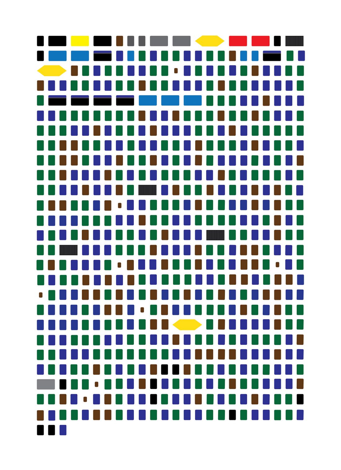
4. One walk in Peckham, 599 bins, Burgess Park
When you stop and look, you will see bins and refuse everywhere, student Laura Raus went for a walk and counted 599 bins on her walk from the Peckham Pelican to Peckham Rye station. For this map, the bins have been abstracted to colours and shapes, then organised in a linear manner like text, inspired by Massimo Vignelli’s minimalist subway maps.
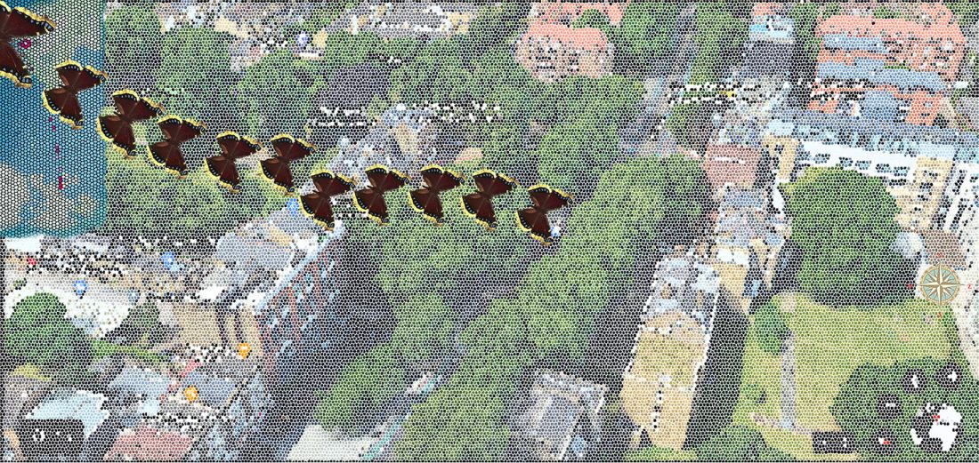
5. Beauty of Camberwell through the eyes of Camberwell Beauty, Wells Way Library and Baths / Lynn AC Boxing Gym, Wells Way
Navya Nagpal created a map looking at Camberwell through the eyes of the Camberwell Beauty, noting that many local places are named after the butterfly, such as Butterfly Walk.
The Camberwell Beauty is also known as the Mourning Cloak, and has one of the longest lifespans for any butterfly. On Wells Street, there is a tiled picture of the Camberwell Beauty placed on the side of the old baths after its removal from the top of Samuel Jones’ Factory following its demolition in 1982.
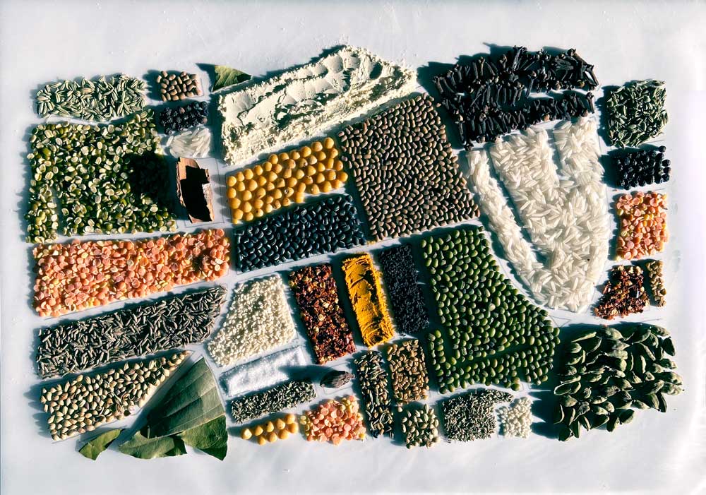
6. Spice + flavour is the key to memory, The Bower Hut, Brunswick Gardens
Sophiyaa Pawar’s map is about the ingredients used in the local area in South and East Asian restaurants. The contrast of colours and textures represent the variety of foods and their complex flavours. Our walk ends in Brunswick Gardens, where you are invited to explore the park and perhaps get a coffee or cake from The Bower Hut.